A Yankee Notebook
NUMBER 1674
August 19, 2013
PADDLING THE CONNECTICUT TRAIL
LEMINGTON, VT – The silver maple (Acer saccharinum), sometimes called water maple or swamp maple, seems to like to get its feet wet. It grows in groves along silty river banks, hanging over the water. When it dies, or is undermined by the river it has shaded, it often falls into the water, which makes life more exciting for canoeists and kayakers who encounter its long branches spanning the current. In early summer its seeds float downriver by the millions, looking for spots to lodge and grow. During floods, the river flows through its groves, easing the pressure on the valley below; and when the floods subside, they leave fresh layers of silt behind. This makes for often gritty camping conditions; but at least the ground is pretty level, and there’s plenty of driftwood left behind. As kids, we called them split maples, because of the deep indentations between the lobes of their leaves. That was also a reminder that silver maple groves are not great places to camp during heavy windstorms, as their multiple trunks are susceptible to splitting, too.
There were probably forty of us gathered in a circle this noon in a lovely silver maple grove beside the upper Connecticut River in the town of Lemington to dedicate a new primitive campsite. Lemington’s a blinker: Blink, and you’re through it. The town clerk was at the gathering. When I asked her if the two buildings I saw in passing were all of it, she nodded. “People from the 251 Club” – the group of Vermonters committed to visiting all 251 of Vermont’s towns – “often drive back and forth looking for it, and finally stop to ask if that’s it. That’s it.”
It may be small, but Lemington, as well as the towns above it and below, from Canaan to all the way down to Lunenberg, boast beautiful, level bottom land. This time of year it’s full of seven-foot-high corn, in some places as far as you can see. The river, already mature, and further domesticated by computer-controlled dams upstream, meanders peacefully through the wide valley. Which is not to say it never gets exciting; I spotted bits of flotsam today, hanging from branches about eight feet above the present river level.
Some of the families living here have owned their land since they were granted it by New Hampshire’s colonial Governor Wentworth in the 18th century. The silver maple grove where we convened at noon was part of one of those grants. Its owner, the late Reggie Ellingwood (who, according to some of the comments at the dedication ceremony, was more than a bit of a character), decided some years ago to grant a conservation easement to a group of “trail partners” for use as a primitive campsite. The Vermont River Conservancy helped make the legal arrangements, installed a picnic table and other campsite amenities, and arranged a luncheon and dedication ceremony. We were there to pay tribute to Reggie’s generosity and vision, dine on pizza and macaroni salad, and head upstream to Canaan for an afternoon voyage. At the end of the river trip, we’d find snacks, more fellowship, and a keg of beer.
Canoeists paddling down the new – and still a-building – Connecticut River Paddlers’ Trail can now pretty much count on an approved place to camp each night as they travel from near the headwaters all the way to the Massachusetts border. They can follow a new multicolored map of the valley that shows the campsites, adds remarks about the type of paddling they’ll encounter as they go, and shows all the access points and portage paths along the way.
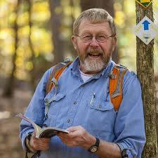
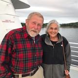
My buddy Bob and I drove up together this morning and met two other ancient members of the Geriatric Adventure Society at the gathering. After lunch, two staff members of the VRC thanked everybody for their help to date and reminded us all how much more needs to be done to secure and maintain access to the river.
One of the unspoken, but nonetheless important background issues, is that of casual use of the campsites by picnickers and partiers, who have less of a stake in maintaining a good relationship with landowners than those of us who need a campsite at the end of a day. So there are frequent volunteer work parties to clean up campsites; install or repair tables, fire rings, signs, and privies; and in some cases fence off fragile natural features. Recreation is one of the potentially most damaging uses of natural, open lands; vigilance and constant effort are crucial to the trail’s success.
The river was lower today than the wet spring had led us to expect. Bob and I have paddled a few hundred miles together, so we managed to thread our way through most of the rocks and snags just below the access point at Canaan. After them, it was pretty clear sailing all the way, as the river meandered between high, silty banks and a lovely tailwind helped us. An occasional aluminum skiff with quiet fishermen was anchored in the smooth current; nobody held up any fish or showed much excitement. A few birds – kingfisher, killdeer, sandpipers, great blues – livened things up a bit. But just as I’d feared it would, my first-day paddling muscle roused from its winter torpor and began complaining. I’ve tried to identify it – possibly an external abdominal oblique – but whatever it is, it’s a stinker. I fed it some naproxen, stopped and got out a couple of times to stretch, and Bob and I soldiered on. “Quit,” thankfully, is not in his vocabulary; quite the opposite.
Finally we spotted the takeout: a high bank and a few people helping paddlers haul their boats and gear up to a grassy parking spot. We made more than our usual graceful landing. Typically, Bob sloshes back from the front to help me get up from my seat; then he holds me upright while I try the first couple of steps to dry land. But the mud was slick. Bob’s feet slipped out from under him, he pulled hard on my hand, and we ended up in a comic mud-wrestling match, with Bob on the bottom. By god! I thought as we flailed, I hope that beer is cold!
